Trajectories of Social-Ecological Systems in Latin American Watersheds (TRASSE)
Study sites
The evolution of rural-urban watersheds in France, Mexico and Colombia has been driven by some SES key variables in such a way that their comparison will allow capturing a large diversity of situations.
France
France centralised governance during the Trente Glorieuses developed a top-down watershed planning both in terms of protected areas and urban and industrial development. While most forests have seen their surface expand, one of the main problems faced by water users has been quality: excess of nitrates and phosphates coming from agriculture as well as organic chemicals such as chlorinated compounds have posed a health and water use problem. Since the late 90’s a progressive devolution of political power at regional level, the harmonisation with Europe in terms of protected areas networks and water standards together with an increase number of local organisations and associations intervening in watershed decisions has created a new environment where bottom-up governance has gained strength. Finally, the increasing number of organic farms, a unique process together with few countries such as Spain, Germany, Italy and the US, has also created a new social-ecological driver in term polycentric governance, local development values and decrease water pollution from industrial chemicals.
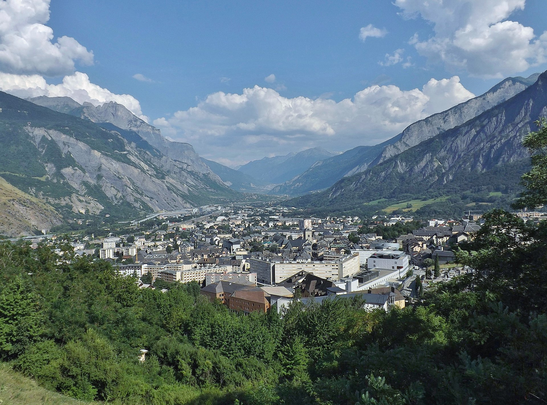
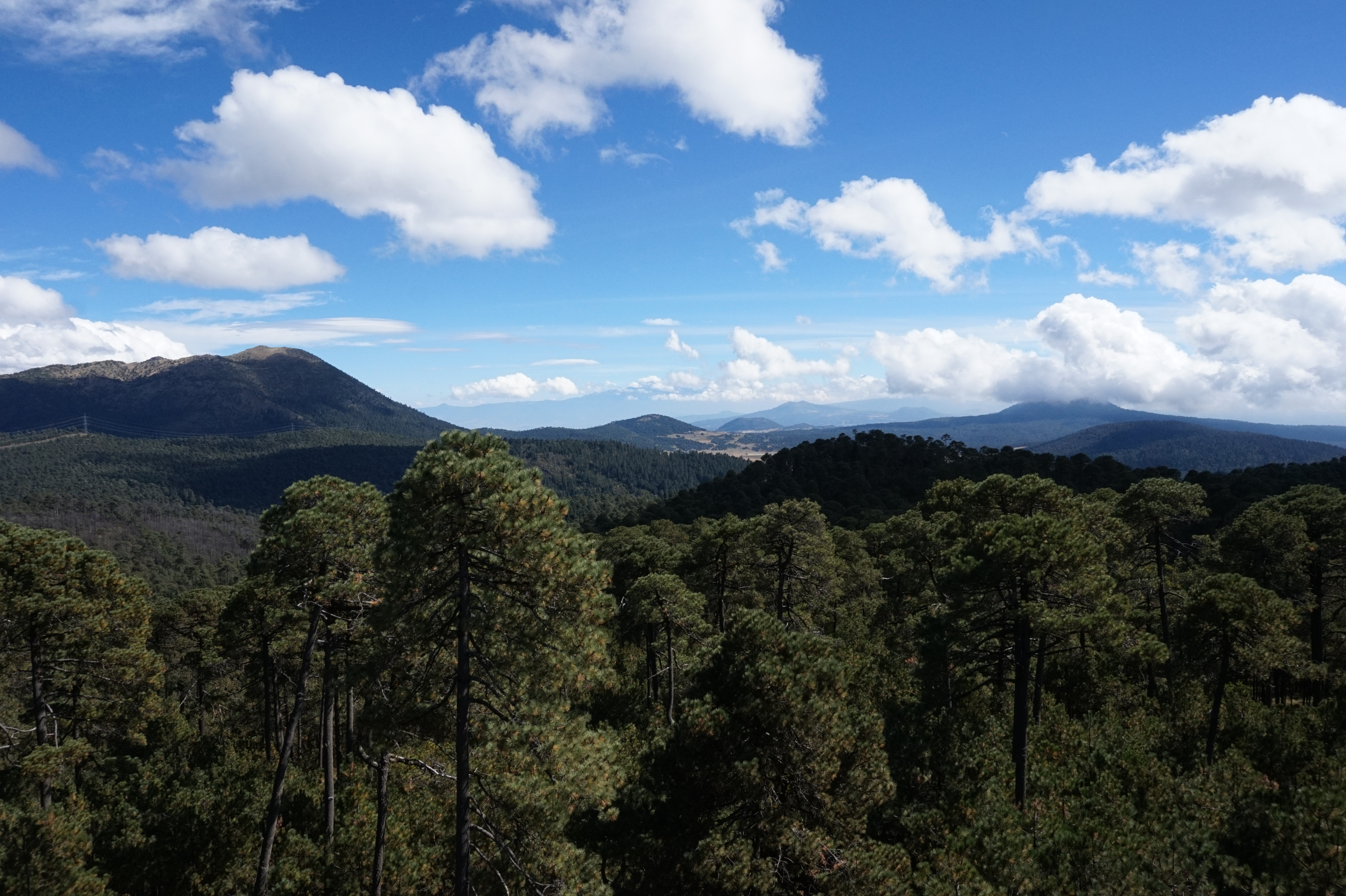
Our study site in France is the Maurienne socio-ecological system. Maurienne is the longest valley in the French Alps, with 56 municipalities and >43,000 inhabitants. Its major drivers of change have been the Insdustrialisation, the modernization of agriculture and its winter and summer tourism.
Maurienne
The Maurienne valley in the French Northern Alps was chosen for its diversity of land use activities, i.e., conservation, farming, tourism, hydro and the range of social, economic, political, and environmental pressures it faces. It presents an emblematic example of an area where competing priorities such as environmental protection and economic livelihoods meet directly at the interface of human society and nature- the cultural landscape and its use.
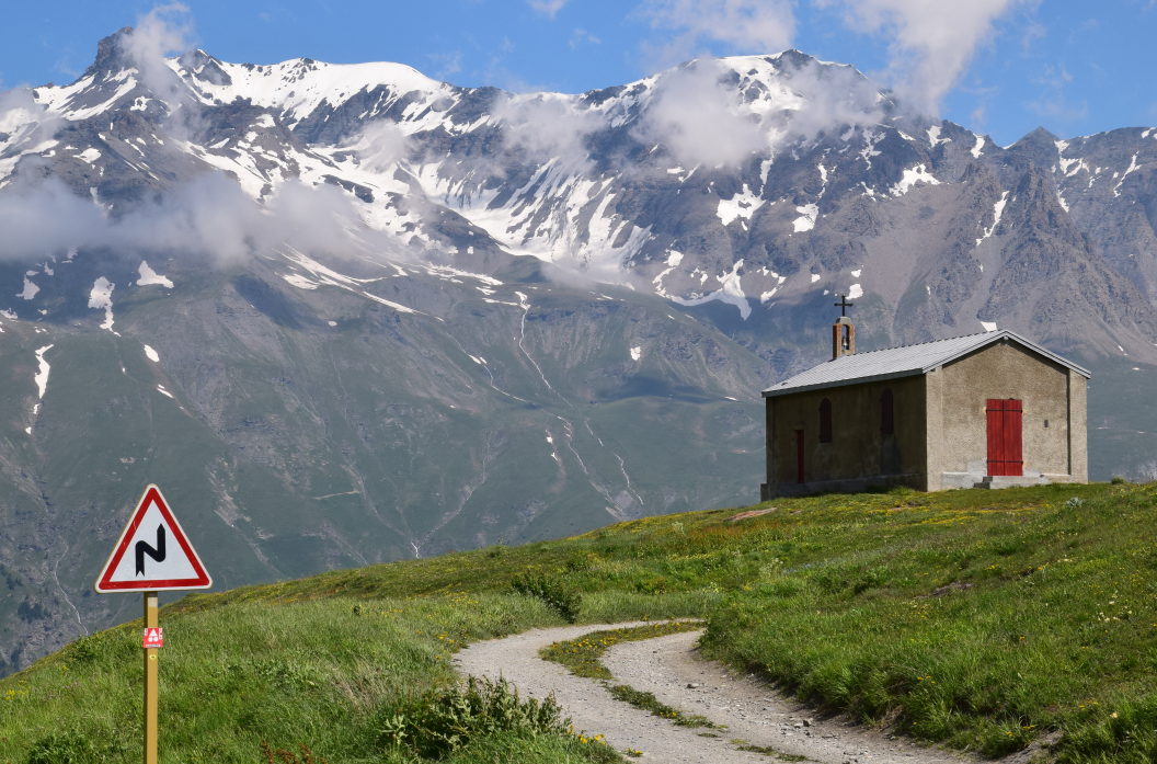
Maurienne is the largest intra-alpine valley in France with a length of 120 km and an average altitude of 2000 m. It is located in the Savoie department and is home to about 40,000 inhabitants. As everywhere in the Alps, the valley has a strong agro-pastoral history which has led to the creation of the current landscape of the valley, characterized by a mosaic of Alpine pastures, meadows and forests.
The valley has undergone major changes over the last few centuries: first of all, there has been extensive industrialization since the end of the 18th century due to the development of hydroelectricity in the area. Then, at the end of the 20th century, a decline in industrial activities and a strong tourist development with the construction of numerous ski resorts. Today, the agro-pastoral system is maintained by the establishment of a low input, high quality, cattle cheese “Beaufort”. This cheese carries the “protected designation of origin” (PDO) label of the European Union.
There are many dynamic interactions between the agro-pastoral system and the tourism system. The maintenance of the open landscape by pastoralism reinforces landscape beauty, while the seasonal employment opportunities of the tourism sector provide an additional income for farmers. Further the local cheese producing cooperatives benefit from the regular inflow of tourists as a relevant key market.
The management of the many risks inherent to mountain areas and the way in which the valley's ecosystems help to reduce them is also of crucial importance for the valley.
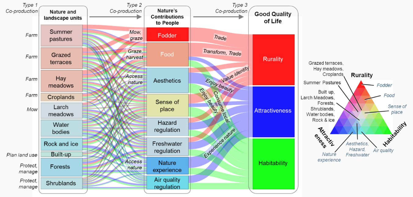
Our study proposes to understand how nature's contributions to people have helped to sustain value-producing subsystems in the valley. Our analysis aims, to analyze the transformations that may have taken place on our site between the 1950s and today through by studying the landscape evolution. Second, we compare the changes in quality and quantity of NCP provided by the ecosystems between the 1950s and today.
Based on our understanding of the past we propose future scenarios for the valley by modelling the possible consequences of climate change on the socio-ecosystems of the valley. Further we examine the role of society in the co-production of these NCP by taking into the account the historical legacies. By qualitatively analyzing associated actors dynamics we strive to understand the current governance of NCP –co-production.
Mexico
Mexico has traditionally experienced hybrid Federal-and-State governance, with some competencies managed at the Federal level and other at the State level. Whereas agriculture has shown diverse patterns of cattle, maize and other commercial crops, it has experienced since the late 80’s a strong urban exodus. The Mexican-endemic form of local governance of ejidosand communitieshas been experiencing a continued disintegration and privatisation of communal lands, the majority of them under forest cover. Deforestation has not been stopped in part to wild fires, cattle expansion and illegal logging. Under the lack of interest and capacity of the federal water authorities to impose a top down organisation of watershed, the coordination of actors at the watershed level is relatively recent and follows a clearly bottom-up and polycentric governance. Some of these examples are the emergence of The Nature Conservancy water funds, local payments for environmental services schemes launched by local water enterprises and international funding from the Global Environmental Fund to coordinate land uses following a “water basin” concept.
Our study sites in Mexico are Mexico City and Copalita-Zimatlán-Huatulco complex.
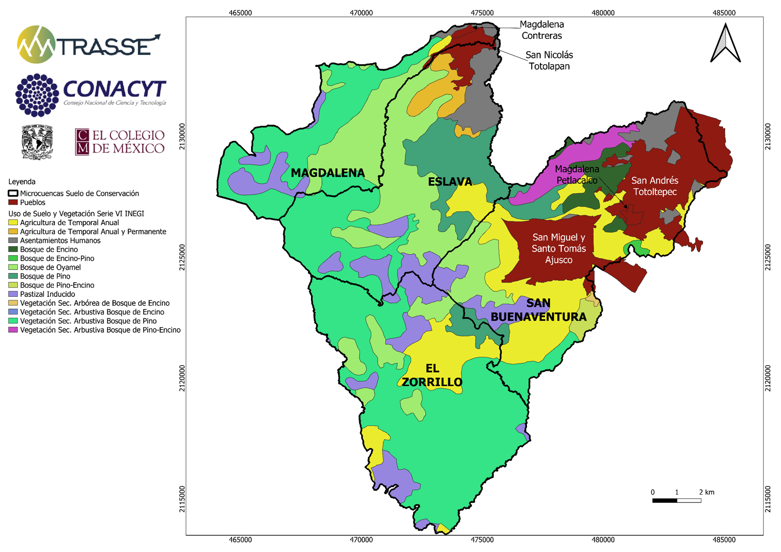
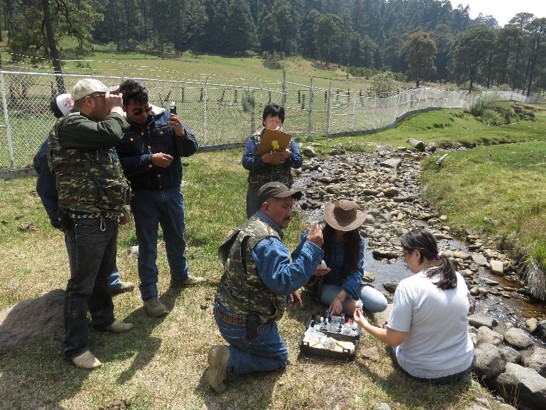
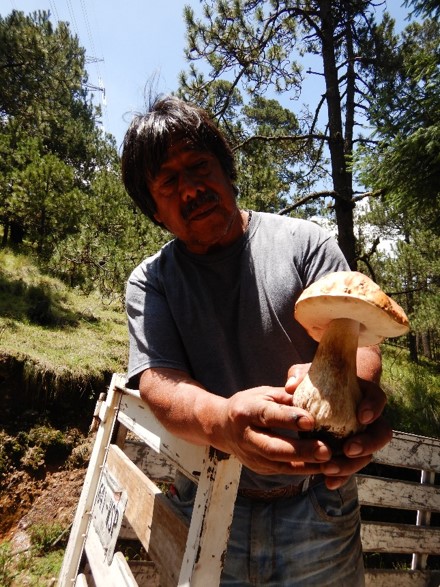
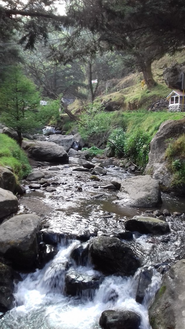
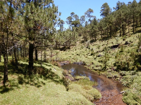
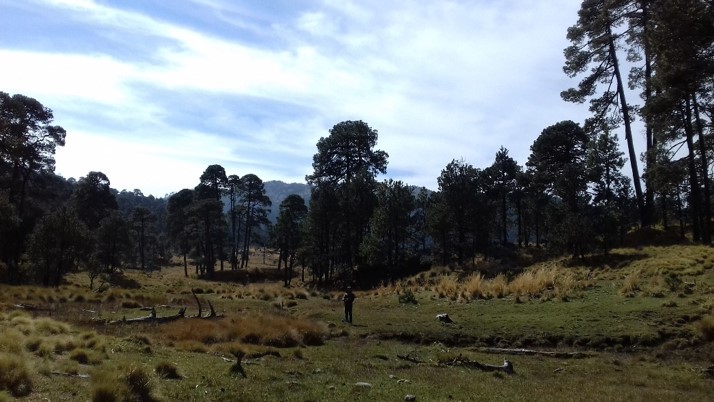
Mexico City is the capital of Mexico and the most populous city in North America, it has a total surface of 1,485 km2 and it is subdivided into Urban and Conservation Land. The 59% of its territory is dedicated to conservation given its ecological and sociocultural relevance and diversity. Its conservation area encloses the 11% of the national biological richness (2% in the globe). Its major problem is the growth of the city, the change of land use and the high rate of deforestation. TRASSE will be focused in the study of 4 micro-watersheds in Mexico City: Eslava, San Buenaventura, La Magdalena and El Zorrillo, where there are different communities with a longitudinal profile and bio-cultural diversity.
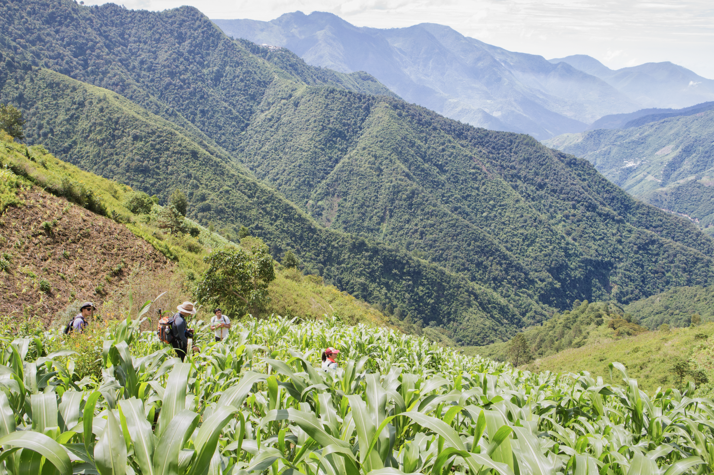
On the other hand, Copalita-Zimatlán-Huatulco complex is located in the south of the mexican state of Oaxaca. It has 74% of the mexican vegetation types, including temperate and tropical ecosystems. The 90% of its population lives under margination, although they provide a lot of services related with the tourism. This complex has a lot of issues related with their main production systems, such as the low profits of their agricultural production, the increasing use of agrochemicals, the expansion of cattle raising, the abandonment and aging of coffee plantations and the lack of infraestructure investment.
Mexico City
The Conservation Land represent 50% of the city of Mexico (CDMX). It includes nearly 50% of forest area and of this 90% is in social property of the land. The CDMX Conservation Land is recognized for important ecosystem services it provides to the city and the region. Particularly, as it is a carbon reservoir and a water supply and regulation area.
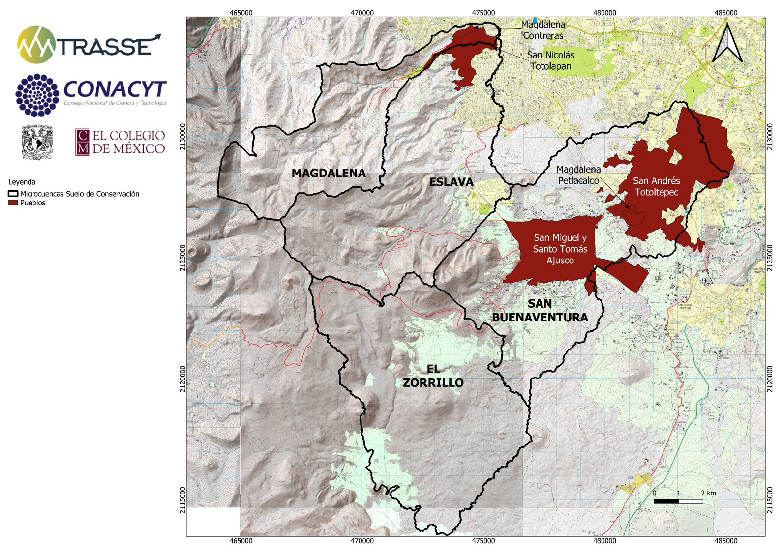
In 4 micro-basins of interest (28 thousand hectares) there are 6 agrarian cores: San Miguel and Santo Tomás Ajusco community, Magdalena Atlitic, ejido of San Nicolás Totolapan, ejido of San Andrés Totoltepec, ejido and community of Magdalena Petlacalco.

More than 335 million pesos have been invested in these agrarian cores between 2000-2018 as instruments of public environmental policy (only 28% corresponds to federal investments); but it hasn't stopped deforestation.
SES conceptualization
Colombia
Colombia has experienced a totally polycentric and decentralised model of watershed governance. In part due to the geographical constraints, in part due to the lack of territorial security that has fragmented the country for more than 40 years, watershed actors have had a mainly uncoordinated model of occupation. While private farmers invested in extensive cattle, municipal water companies assured water provisioning in terms of volume and hydraulic infrastructure without a real connection with the territory. Only some recent institutional initiatives around the capital of Bogota and the city of Manizales have attempted to propose bottom-up coordinating policies –like the Procuenca project in Manizales initiated by FAO in 2007. Under the post-conflict context and the possible reorganisation of land to create peasant territories, including the political re-integration of large parts of the territory –some mountain areas, a complex social-ecological trajectory is about to begin. In particular, the way local and national governance will be able to find synergies or enter in conflict will affect the sustainability of ecosystem services –e.g. the recent opposition of the Cajamarca population to the AngloGold Ashanti gold mine.
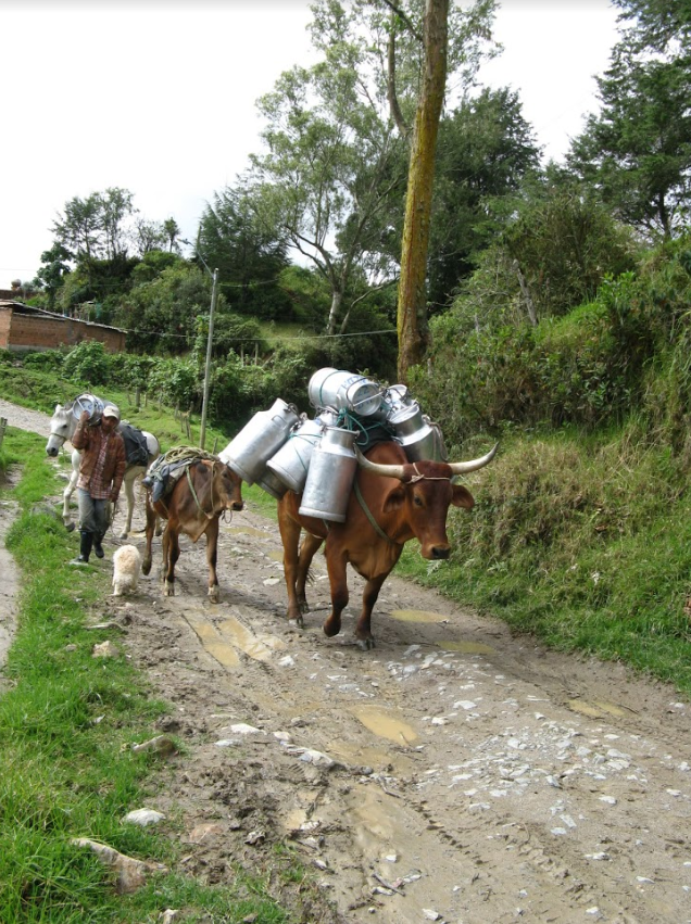
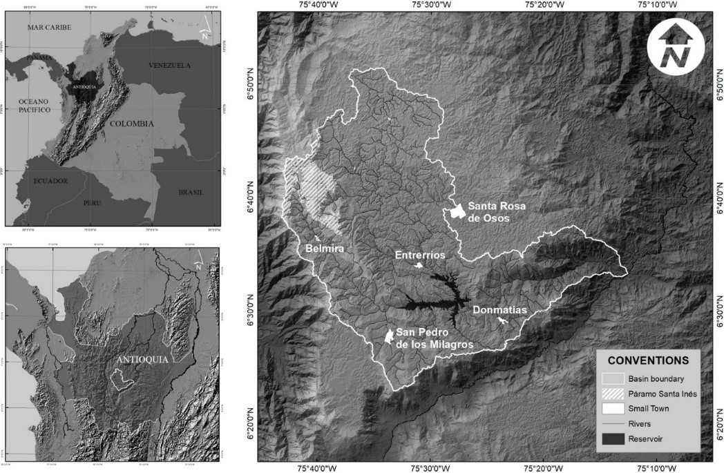
TRASSE Project will be focus in the Riogrande Basin, located in the Northwest of Medellin. Some of its major problems are the high levels of deforestation, the loss of biodiversity, the expansion of agriculture and livestock activities, the high dependence of chemical inputs for production, the pollution of the water sources, the increase in intensity of flooding events caused by deforestation, the overexploitation of land, the low presence of environmental institutions, the health problems related with water pollution, and the communities’s lack of awareness of environmental problems.
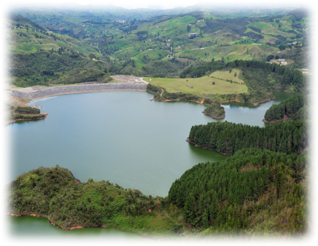
RIOGRANDE BASIN
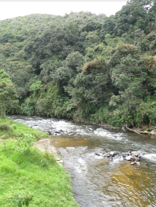
Riogrande basin (RGB) is located in the North-west region of Colombia with five municipalities within it. The average temperature of the area is 15°C with annual precipitation between 2,000 and 2,500 mm per year. Within the basin, there are ecosystems of strategic importance, and the local environmental authority protected them through the declaratory of and integrated management system called “Distrito de Manejo Integrado de los Recursos Naturales Renovables, Sistemas de Páramos y Bosques Alto Andinos del Noroccidente Antioqueño” in Spanish with a total area of 21.603 Ha from which 6.043 corresponds to Páramo. Within the basin is the Riogrande II reservoir, which is a source of the water and energy for the 32% of the population of the Metropolitan Area of Aburrá Valley, the second largest populated center in the country. The basin is a source of livestock products for different areas of the country and has growing tourism potential.
Despite its strategic importance, the ecosystems in the basin have considerably changed with the introduction of livestock and agriculture production. The patterns of settlement and forest loss show spatial interdependencies because of decisions made at the farm level (Ramírez et al., 2018). The strategic character of the basin together with the land use transformations makes it a suitable territory for studying socio-ecological risk to changes in ecosystem services provision.
LOCATION
The total area of RGB is about 127,896.29 hectares (ha) (1,278.96 km2). From the total area of the basing 61.62% is pasture mainly dedicated to dairy cattle farming, 28.99% is semi-natural areas (forest, paramos, forest plantations and shrubs in different successional stages) with productive and protective uses; 1,54% in agriculture. The remaining 7,85% is infrastructure, small mining processes, water surface and degraded areas (CORANTIOQUIA and UNAL, 2015).
Given the strategic importance of this area, since fifteen years ago different institutions have designed a series of plans, programs, and policies to restore and conserve strategic ecosystems for the region. For instance, government authorities and local actors of the Riogrande basin have led a regional planning instrument with the purpose to preserve and guarantee the supply of water. This planning instrument is called POMCA by its acronym in Spanish (Plan de Ordenamiento y Manejo de Cuencas hidrográficas). Other policy instruments such as Payment for ecosystem services schemes, protected areas and conservation initiatives of the community complement this plan.
The total population in RGB basin is approximately 68,000 inhabitants. The primary sources of income are dairy cattle farming, poultry farming, pork farming and in less proportion agricultural activities like potato crops, tamarillo, and coffee in the lower area of the basin. In the urban areas, the development of agro-industry services that support agriculture and livestock activities is the primary source of income. Although the beneficiaries of the services provided by the ecosystems in the basin are located not only within the basin but outside it, for this study, we only focus on the beneficiaries who live in RGB and whose income and way of life depend on the in-situ ES.
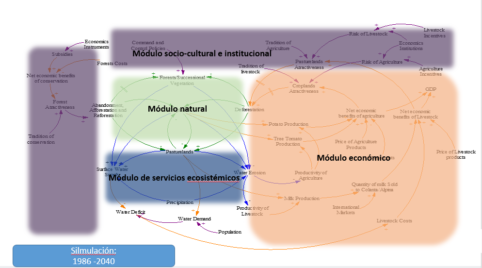
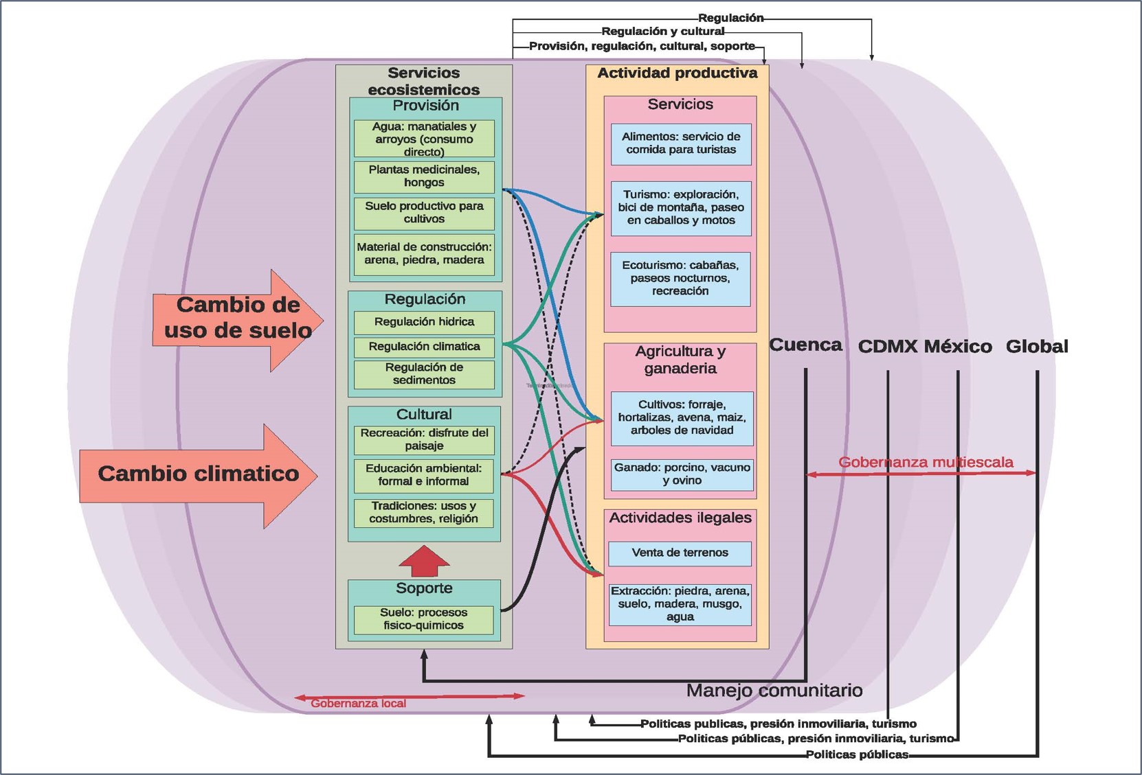
CONCEPTUAL MODELLING